Geospatial Intelligence & Data Solutions
- Home
- Services
- Geospatial Intelligence & Data Solutions
Geospatial Intelligence & Data Solutions
Actionable Intelligence from the Sky to the Surface!
At RJR Services, we harness the power of Geospatial Technology to deliver data-driven clarity, efficiency, and sustainability. Decisions are only as good as the data they’re based on. We transform raw satellite and spatial data into a powerful decision-making platform, providing you with the clarity to manage assets, mitigate risks, and optimize outcomes across your operations through
🌍 What Are Geospatial Technology Solutions?
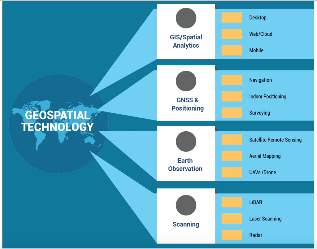
Geospatial Technology refers to the suite of tools and systems — such as GIS, GPS, remote sensing, and spatial analytics — that enable the collection, analysis, and visualization of geographically referenced data.
At RJR Services, we leverage these technologies to help clients monitor change, assess risk, plan smarter, and measure impact. From satellites to field sensors, our solutions unify data into powerful insights that support climate resilience, sustainable growth, and operational excellence.
Our Approach:
For Geospatial Technology implementation we:
- Understand Objectives – By assessing your business or project goals, key metrics, and decision needs.
- Technology Integration – We combine satellite, drone, IoT, and GIS data into unified platforms.
- Spatial Analysis & Automation – Using AI and spatial models, we analyze patterns, detect trends, and automate workflows.
- Visualization & Reporting – Results are delivered through interactive dashboards, GIS portals, and real-time visualizations for stakeholders.
Our Geospatial Intelligence & Data Solutions
Spatial Intelligence & Data Visualization
Transform complex spatial data into clear, intuitive, and interactive maps and dashboards. Communicate insights effectively and make data-driven decisions with ease, seeing the whole picture at a glance.
Advanced Geospatial Analytics
Go beyond simple mapping. Our sophisticated analytics uncover hidden patterns, trends, and relationships within your spatial data, delivering predictive insights that give you a strategic advantage.
Enterprise Geospatial Platform Solutions
Integrate the power of location intelligence across your entire organization. We deploy scalable, secure geospatial platforms that centralize your spatial data, streamline workflows, and empower every team with the insights they need.
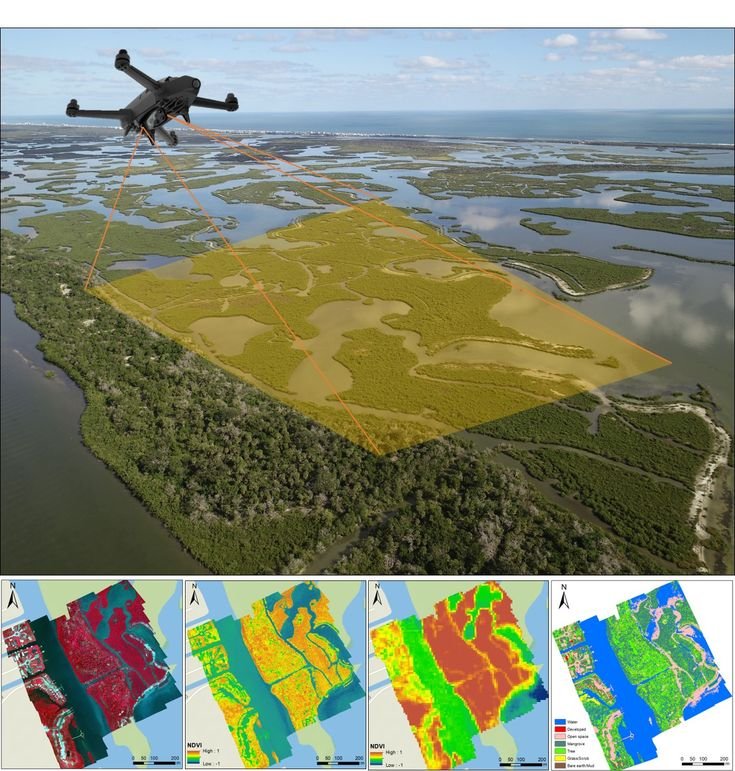
Satellite-Derived Insights & Monitoring
Gain a persistent, unbiased view of your assets and projects from space. We use satellite imagery to monitor vegetation health, track changes over time, and verify on-ground activity, providing reliable data at scale.
Geospatial Intelligence (GEOINT) Solutions
Most advanced offering, fusing imagery, data, and context to solve complex strategic challenges. GEOINT provides a comprehensive understanding of your operational environment for security, risk management, and large-scale planning.
Technology That Connects Data, People, and Planet
At RJR Services, we believe geospatial technology is more than a tool — it’s a bridge between sustainability and innovation.
Our mission is to help you see the full picture, optimize performance, and achieve your environmental and operational goals through the power of location intelligence.
Why Choose RJR Services:
- Integration of GIS, Remote Sensing, and AI technologies
- Proven experience in environmental and climate data solutions
- Scalable systems built for public, private, and industrial sectors
- Real-time insights through interactive dashboards
- End-to-end support — from design to implementation
Way Towards Net Zero:
To help drive the transition to net zero, the Australian Government has set a target to reduce emissions to 62-70% below 2005 levels by 2035. Australia’s abundant renewable energy resources provide the foundation to decarbonise our electricity system, reduce our reliance on fossil fuels in industry, transport and buildings through electrification, and produce new green commodities.