Geospatial Technology Solutions
- Home
- Services
- Geospatial Technology Solutions
Geospatial Technology Solutions
Empowering Decision-Making Through Location Intelligence
At RJR Services, we harness the power of Geospatial Technology to deliver data-driven clarity, efficiency, and sustainability. Our Geospatial Technology Solutions integrate advanced GIS platforms, remote sensing, spatial analytics, and AI-powered automation to help organizations visualize, analyze, and manage complex environmental and operational challenges with precision.
Whether you’re monitoring land use, managing infrastructure, or optimizing carbon and sustainability projects, we transform geospatial data into actionable intelligence that drives confident decisions.
🌍 What Are Geospatial Technology Solutions?
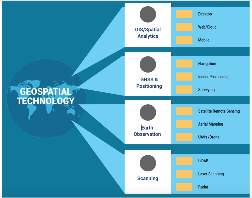
Geospatial Technology refers to the suite of tools and systems — such as GIS, GPS, remote sensing, and spatial analytics — that enable the collection, analysis, and visualization of geographically referenced data.
At RJR Services, we leverage these technologies to help clients monitor change, assess risk, plan smarter, and measure impact. From satellites to field sensors, our solutions unify data into powerful insights that support climate resilience, sustainable growth, and operational excellence.
Our Approach:
For Geospatial Technology implementation we:
- Understand Objectives – By assessing your business or project goals, key metrics, and decision needs.
- Technology Integration – We combine satellite, drone, IoT, and GIS data into unified platforms.
- Spatial Analysis & Automation – Using AI and spatial models, we analyze patterns, detect trends, and automate workflows.
- Visualization & Reporting – Results are delivered through interactive dashboards, GIS portals, and real-time visualizations for stakeholders.
Our Geospatial Technology Solutions
GIS System Design & Implementation
Custom-built Geographic Information Systems tailored to your operational requirements.
- Enterprise GIS architecture design
- Data integration and spatial database management
- Cloud or on-premise deployment and configuration
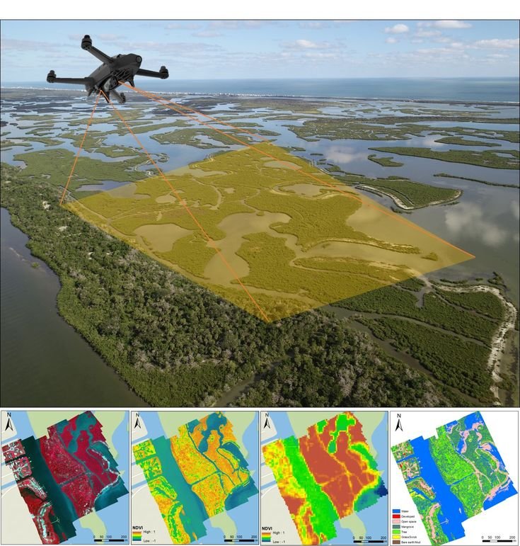
Remote Sensing & Satellite Data Processing
Extract critical insights from multi-spectral and radar satellite imagery.
- Land use, vegetation, and water body mapping
- Change detection and environmental trend analysis
- Carbon, soil, and ecosystem monitoring
Spatial Data Infrastructure (SDI) Development
Enable data sharing and collaboration across departments and projects.
- SDI framework creation and metadata standardization
- Interoperability and open-data system setup
- Secure access controls and API integrations
GeoAI & Predictive Analytics
Using Artificial Intelligence to turn geospatial data into foresight.
- Land use classification and change prediction
- Carbon yield and resource optimization modeling
- Automated feature detection using machine learning
Interactive Dashboards & Visualization Tools
Simplify complex data through intuitive, web-based platforms.
- Custom-built dashboards for monitoring and reporting
- Integration with ArcGIS, Power BI, or custom front-end systems
- Real-time project performance tracking
Data Management & Quality Assurance
Ensure your geospatial data remains accurate, reliable, and compliant.
Data validation and accuracy checks
Version control and update management
Compliance with ISO and OGC data standards
Technology That Connects Data, People, and Planet
At RJR Services, we believe geospatial technology is more than a tool — it’s a bridge between sustainability and innovation.
Our mission is to help you see the full picture, optimize performance, and achieve your environmental and operational goals through the power of location intelligence.
Why Choose RJR Services:
- Integration of GIS, Remote Sensing, and AI technologies
- Proven experience in environmental and climate data solutions
- Scalable systems built for public, private, and industrial sectors
- Real-time insights through interactive dashboards
- End-to-end support — from design to implementation
Way Towards Net Zero:
To help drive the transition to net zero, the Australian Government has set a target to reduce emissions to 62-70% below 2005 levels by 2035. Australia’s abundant renewable energy resources provide the foundation to decarbonise our electricity system, reduce our reliance on fossil fuels in industry, transport and buildings through electrification, and produce new green commodities.