Earth Observation Solutions
- Home
- Services
- Earth Observation Solutions
Earth Observation Solutions
Unlocking Environmental Intelligence from Space
At RJR Services, we leverage cutting-edge Earth Observation (EO) technologies to deliver high-resolution insights about the planet’s surface — enabling organizations to make smarter, faster, and more sustainable decisions.
Through the integration of satellite imagery, remote sensing, and geospatial analytics, our Earth Observation Solutions transform raw satellite data into actionable intelligence for environmental monitoring, climate resilience, carbon project validation, and sustainable land management.
🌎 What Are Earth Observation Solutions?
Earth Observation (EO) involves the collection and analysis of data from satellites, drones, and airborne sensors to monitor and measure natural and built environments.
At RJR Services, we convert this continuous stream of Earth data into precise, verified information that supports sustainability goals, carbon accounting, and decision-making across multiple industries — from agriculture and forestry to energy and infrastructure.
Why Earth Observation Matters?
Enables large-scale environmental visibility and transparency
Reduces field survey costs and time
Provides objective, satellite-verified project data
Supports sustainability reporting and regulatory compliance
Improves accuracy in carbon, climate, and land management decisions
Our Earth Observation Solutions
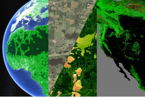
Land Use & Land Cover (LULC) Mapping
Identify and track changes in land use and vegetation cover over time.
- Automated classification using machine learning
- Detection of agricultural expansion, deforestation, or urban growth
- Time-series change detection for compliance and reporting
Vegetation Health & Biomass Monitoring
Assess vegetation health, density, and productivity using multi-spectral indices.
NDVI, EVI, and LAI analysis
Early detection of stress, degradation, or disease
Biomass estimation and growth rate forecasting
Soil & Moisture Analysis
Monitor and optimize soil conditions for agriculture and restoration projects.
Soil moisture and temperature mapping
Surface reflectance and soil carbon estimation
Land degradation and erosion analysis
Climate & Environmental Monitoring
Gain a macro view of environmental performance and climate impacts.
- Rainfall, drought, and temperature variability tracking
- Water body mapping and hydrological change detection
- Extreme event (fire, flood, heatwave) monitoring
Carbon Project Verification Support
Enhance transparency and validation in carbon offset projects.
- Satellite-based MRV (Monitoring, Reporting & Verification)
- Forest canopy growth tracking and carbon density estimation
- Compliance-ready spatial datasets for registries and auditors
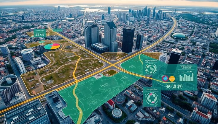
Customized EO Data Dashboards
Visualize your environmental performance in real time.
Interactive dashboards for project tracking
Multi-layer map integration (carbon, land, climate)
On-demand analysis with cloud access for teams and stakeholders
See the Bigger Picture, Act with Precision
With RJR Services’ Earth Observation Solutions, you gain the ability to see change, measure impact, and make data-driven environmental decisions with confidence.
From global-scale observation to site-level insights — we bring the planet’s data to your desktop.
Why Choose RJR Services:
Way Towards Net Zero:
- Integration of high-resolution multi-sensor satellite data
- Expertise in environmental and climate analytics
- Scalable EO solutions tailored for any project size
- Compliant with national and international sustainability frameworks
- Seamless integration with GIS and enterprise systems
To help drive the transition to net zero, the Australian Government has set a target to reduce emissions to 62-70% below 2005 levels by 2035. Australia’s abundant renewable energy resources provide the foundation to decarbonise our electricity system, reduce our reliance on fossil fuels in industry, transport and buildings through electrification, and produce new green commodities.